
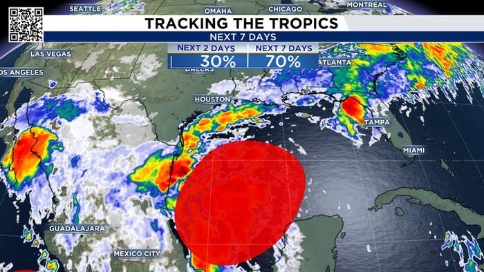
While it is getting long in the tooth, the 2026 Atlantic season isn’t over just yet! We’re kicking off the new work week with a cluster of storms in the Bay of Campache in the southern Gulf that now has a 70% chance of becoming the next named storm, “Isaias”.


The “storm” hasn’t formed yet, meaning there is no core of surface circulation for models to lock onto so think of this analysis as a first look at a possible forecast. While it is October, the Gulf surface temperatures are still very warm, in the mid to upper 80s, plenty of juice to help fuel tropical development.

Once we get a center to the “storm”, we’ll be able to use the full array of modeling data, which should happen within the next 1-2 days. For now, a very early look shows the majority of the effects of the storms will stay well east of Texas. Areas from Louisiana to the Florida Panhandle may be seeing significant rainfall.

Now, there WILL be changes to this forecast, so make sure to check back often for updates, but at this time, we aren’t anticipating any major impacts across SE Texas.


